If you were schooled in the US, you would absolutely have seen such a map nearly every day.
Edit: Sorry I offended someone! If you were educated in the US and had another experience, I'm not invalidating that. I was in HS a few decades back, and I think they've probably reformed those maps these days
The upstream reply asked "I don't think I've ever seen a map that places United States in the center. Is that really a thing?"
So, your question is different.
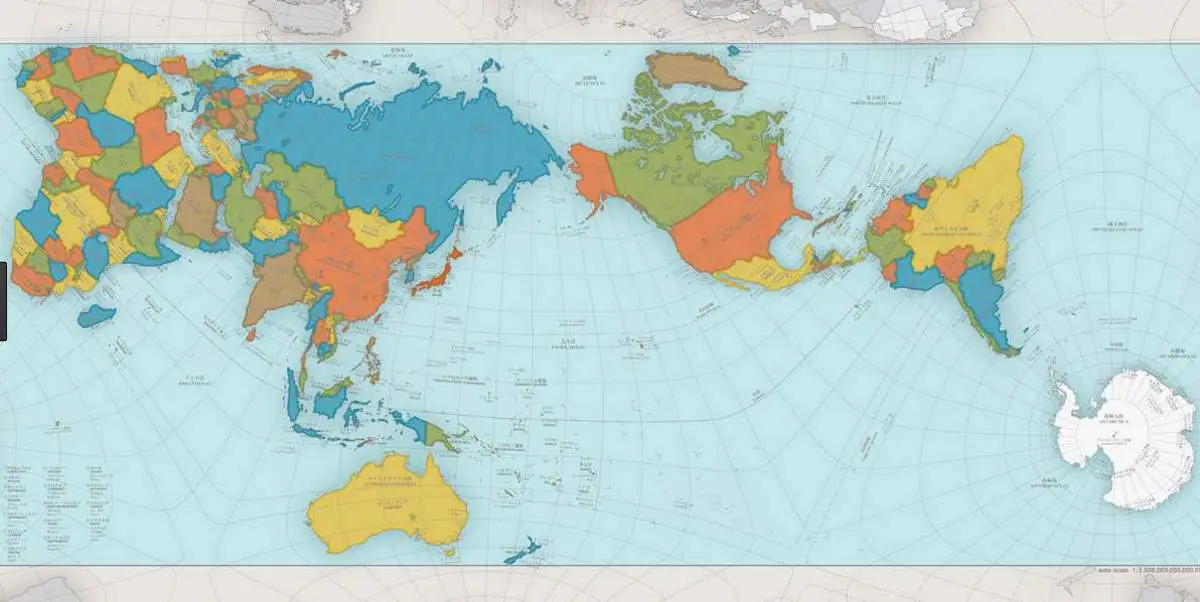
But yes, to answer your question, in school we also had global maps that centered the Americas and split Asia so that China was on the left and Europe and Africa was to the right
I think it was split somewhere to the west of India, as I recall. The projection may have been over the US, but Im not positive. It was awhile ago
As far as I recall, that map was never used in my American education. I'm guessing it's decided by state education boards, so either you always had it or never had it.
Yes, that is how it 'works', splitting up Russia/Asia.
I was downvoted simply for suggesting another poster who hadn't seen it before, and was it really a thing, do a search so they could see different examples it.
Other people here are downvoted simply for giving their (American) experience, that maps showed the US at the centre.
I had an American experience in several different schools, and our maps had the Atlantic in the middle. I think that's more common, so people are down voting the posts stating the bizarre America in the center map is a staple of US schools.
It's probably something decided by state education boards, so whichever map your state decided was all you saw for twelve years. Leading you to think the entire US had the same.
Yes, you could be right with that. I guess not enough kids are playing Risk.
Although it can seem pettily nationalistic (and probably is to some extent), for quickly illustrating "You Are Here", and the relative positions of other countries to your own, centring maybe makes more sense than having some far away country at the centre.
It seems pretty common/natural in different countries too. I wondered if a 'most accurate map' exists, and found Authagraph:
I’m an American who was in high school in the late ‘90s, and I can’t recall ever having seen such a map before this discussion (though obviously they exist). Perhaps it was changed somewhere in that time span? Or a regional difference?
Edit: perhaps more relevant that I went to private schools, so we wouldn’t necessarily have had the same materials as were chosen by the state.
New Zealand often complain they are left off maps of the world (it happens more than you think). I do wonder if NZ maps leave off other countries (say the UK) in response.
My point (and probably my parent's too) is that America has dominated the shared culture for the past 100+ years (in good part thanks to Hollywood). Most people experience world maps and globes in two places: in schools, where they will be local-oriented, and in movies, which will be predominantly American.
(And if you're into science fiction, you've likely internalized the American view of Earth from space without even realizing it.)
I'm not passing judgement here - just saying that cultural influence isn't equal.
Eh, I'm not sure how much influence movies have over maps. I live in the UK which has a very significant cultural influence from the US, but the vast majority of maps I see are centered on the UK.
The movies won't affect your printed maps, or maps you see in serious contexts (like in classroom, or in a BBC article). But I'm willing to bet that in your day-to-day experience, you see a roughly equivalent number of maps in movies and videogames. Which, unless you have non-average watching habits, will most likely be US-made.
I probably do see a fair number of those maps, but the context matters. Such maps are usually in the background and not what I'm paying attention to. If I'm actively using a map then it's a UK centered one 99% of the time.
Edit: Sorry I offended someone! If you were educated in the US and had another experience, I'm not invalidating that. I was in HS a few decades back, and I think they've probably reformed those maps these days