|
|
|
|
|
|
by orbifold
4395 days ago
|
|
|
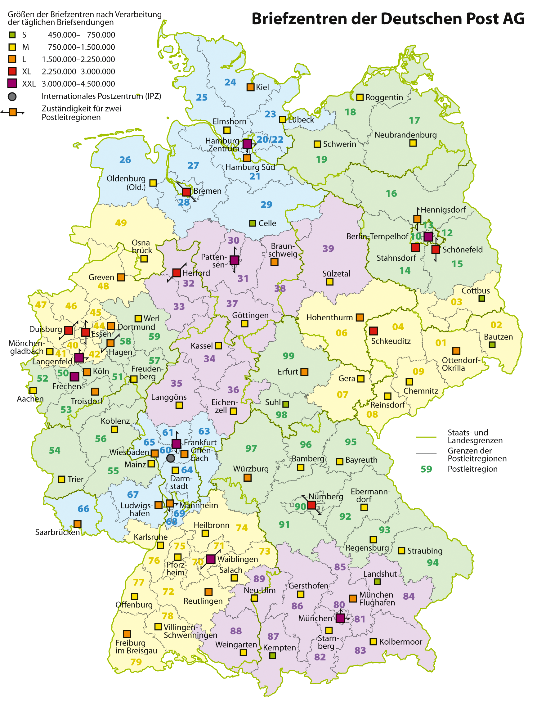
I think that postcodes divide a country not evenly but are chosen by population density and the distribution structure of the post provider. Look at http://upload.wikimedia.org/wikipedia/commons/8/8e/Karte_Bri... for example, each distribution center is responsible for one or two double digit prefixes, the first digit roughly indicates the region. Areas with high population density have a much finer coverage. I don't think there would be any benefit from switching to Map Codes, as they have to be mapped to something like post codes anyways and they are not precise enough to serve as residential addresses. |
|
|