|
|
|
|
|
|
by 001sky
4647 days ago
|
|
|
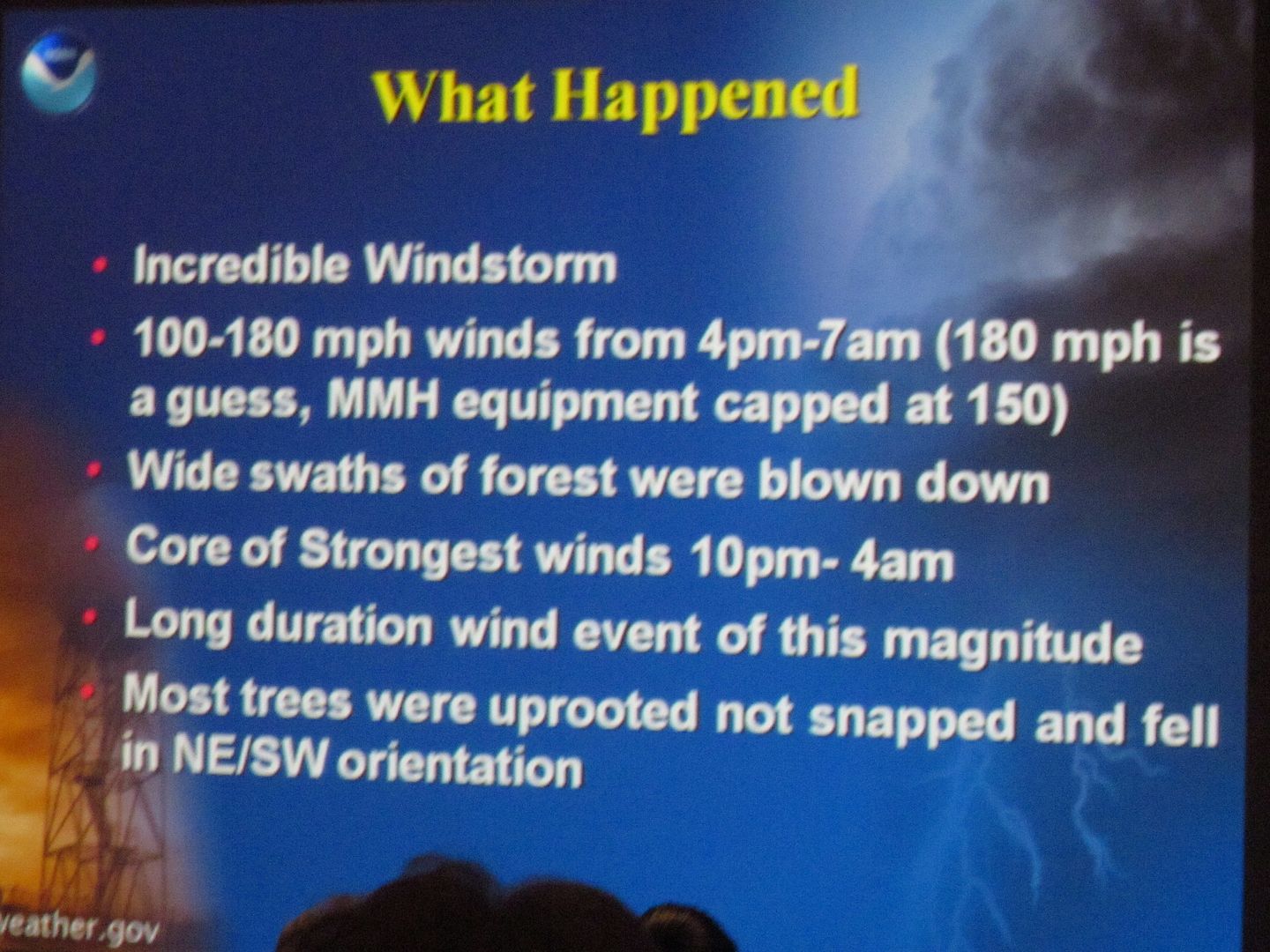
The wind was reported at 195 mph with 235 mph gusts That's insane. I'm sure it would rip out most testing equipment. I've seen the damage from similar micro-bursts (<200mph) in the US and nothing is left standing. And I mean nothing alive. Complete devastation. It would look like thos pictures from when the meteor hit Siberian in the early 20th century. A mess of matchsticks. _______ edit: updated info Haiyan attained its peak intensity with ten-minute sustained winds of 235 km/h (145 mph) one-minute sustained winds of 315 km/h (195 mph) and gusts up to 378 km/h (235 mph) Still a record, but the sustained winds are more in the mid 100's rather than approaching 200. Immensely strong peak gusts. 10 minutes of that at peak energy must have seemed like a lifetime. There is no natural shelter in these situations. Truly, truly dangerous. Edit2: like here> http://forums.mammothmountain.com/viewtopic.php?f=15&t=12869... |
|
|
http://qz.com/144734/super-typhoon-haiyan-one-of-the-stronge...
> Super Typhoon Haiyan hit the Philippines at 4am local time today with winds near 195 mph, making it the strongest tropical cyclone to make landfall in recorded world history, according to satellite estimates. That astounding claim will need to be verified by actual measurements at ground level, which should be collected over the coming days.
> The storm (known as Yolanda in the Philippines) has officially maxed out the Dvorak scale, which is used to measure strong strength using satellites. That means Haiyan has approached the theoretical maximum intensity for any storm, anywhere. From the latest NOAA bulletin:
Here is a wikipedia link to the Dvorak scale.
http://en.wikipedia.org/wiki/Dvorak_technique