|
|
|
|
|
|
by shiroiushi
643 days ago
|
|
|
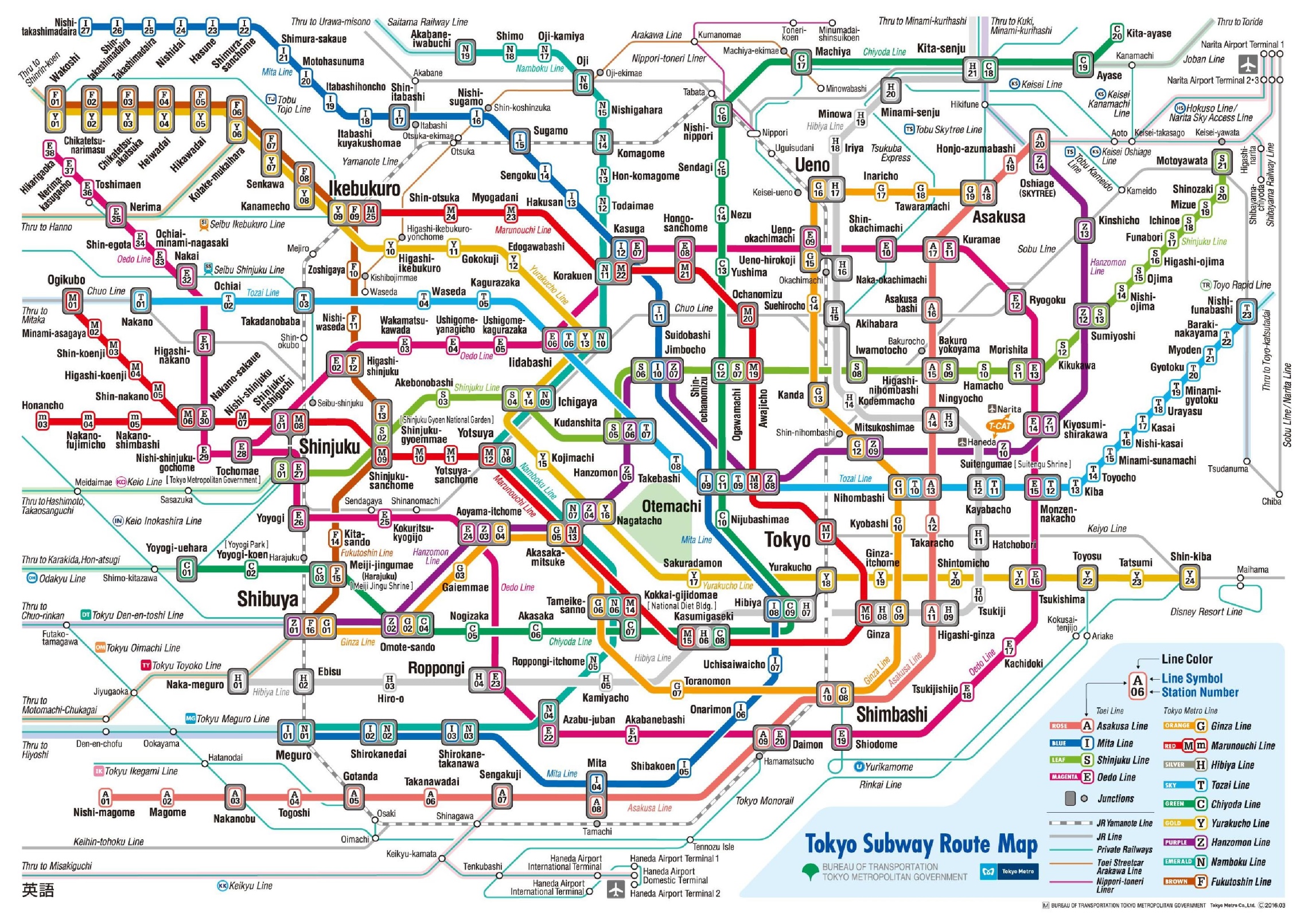
It is missing most of Tokyo. All they did is look at the subways, specifically the Tokyo Metro system, and maybe a few other lines. The JR rail lines aren't on there, and no transit map of Tokyo is complete without those. The Yamanote line, in particular, is a crucial piece of Tokyo's transit infrastructure, and it's perfectly normal for people to transit between the underground Tokyo Metro and above-ground JR East lines. Most likely, they just left out the JR Rail and other lines because the map is way too complicated with them, or perhaps it broke their algorithm. They also didn't show the entire Tokyo metro area, which is much larger than this and includes Yokohama. It's understandable, though: the entire Tokyo metro area is enormous (though perhaps not compared to many American cities like Phoenix, if you just look at land area, but those cities have nowhere near the density of Tokyo), and a map of the entire thing is usually too complicated to bother with, so zoomed-in maps are more useful. This one is showing central Tokyo (the part encircled by the Yamanote line) and parts not too far from it. |
|
|
The answer for this, I think, is that either the OSM data (input) needs to adapt to fit what this system can read or patch rules and patch data can be applied to fix up the output.
Either way it is a distributed project, people in Tokyo or Hannover or any place where it is wrong are the people who would know what is right so they should be engaged in the solution.