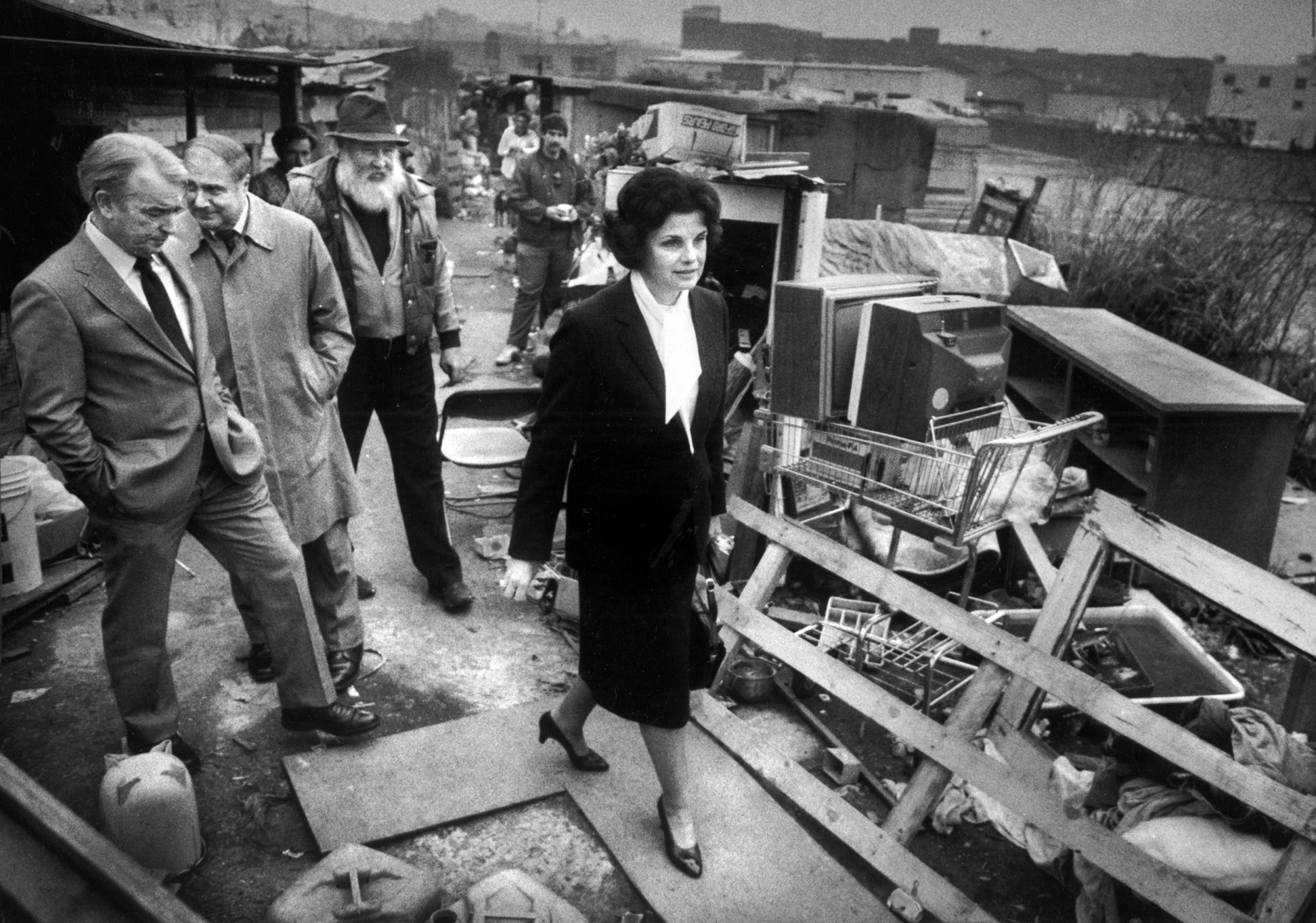
"Mayor Dianne Feinstein leads a group on a tour of Shantytown at Seventh and Berry streets in 1986. The group includes her press secretary Tom Eastham (left), Public Health Director David Werdegar and Thomas Dalton, “mayor of Shantytown.”
Not really "four blocks" by the way that most people would measure blocks. Berry Street stops at 6th Street and restarts on the other side of the Caltrain tracks at 7th. On top of that, the blocks in that part of the city are quite huge, probably 3 to 4 Manhattan street blocks.
There is still a shantytown that gets built up on 7th street every so often and is torn down once it gets big enough. I saw a well-constructed hut there that had a fire extinguisher mounted to the outside, with a building-code sign saying "Fire Extinguisher" pointing to it.
It looks like this photograph was probably taken on Berry street on the other side of the Caltrain tracks, near the Embarcadero Freeway, and "7th and Berry" is only an approximate location.